The original Aboriginal inhabitants of the Wollongong area are the Dharawal people. The Dharawal people lived in the Illawarra and Shoalhaven districts but also in other coastal areas of Sydney between Broken Bay/Pittwater, Berowra Waters, south west to Parramatta and Liverpool. The traditional language of this tribe was also known as Dharawal and this language was spoken from Sydney in the north to as far south as Bega.
Wongawilli and the surrounding area would have provided dry higher ground for camping but considering that a reliable water supply was not within close proximity, it is most likely that the area was not used for long-term occupation but, for foraging activities a good vantage point or as a passing corridor, following the creek from the escarpment to the ocean.
The tool kit of the Dharawal people in the Illawarra region was complex and adapted to each specialised environment. The basic implements can be divided into two groups: ‘extractive’ and ‘maintenance’ tools. Within The Ridge precinct Sheargold undertook through Biosis Research an Aboriginal and archeological and cultural heritage assessment. During that assessment a number of pits where excavated, resulting in the recovery of a number of artifacts. The accompanying pictures show the recovered artifacts which are examples of the tools referred to above.
The suburb of Wongawilli was gazetted by the Geographical Names Board in 2005, however, as a region it has a long and diverse history.
1815 was the year that the Europeans originally came into the Illawarra and within thirteen years the lands in the Wongawilli region were granted to the early European settlers. The lands were cleared and used for mixed farming. The factory based dairy industry did not emerge until later in the nineteenth century.
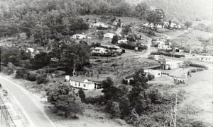
Mining was to contribute to the major growth of the population and the settlement at Bankbook Hill (pictured) was typical of the unplanned villages that sprang up around mining enterprises throughout Australia at the time. As the mining community grew, the mine owners dedicated land to the first church and Wongawilli Public School, that was opened in 1928. The original location of the school, at the corner of Smiths Lane and Wongawilli Road indicates that the population was expected to extend along both roads.
The Wongawilli settlement that exists today, developed from a parcel of land owned by the mine owners in 1936. It comprised 25 lots, 8 of which already had houses constructed on. The parcels of land differed in size and this possibly reflected the status of the miner seeking a home site. Not all of the parcels of land went to the mining community with eight being purchased by non miners. Houses were either built in situ or were moved from surrounding areas, for example, from the vicinity of Jersey farm road when the coke ovens were being constructed. The mine still operates today.

The history of agriculture at “Coral vale” is representative of the Illawarra region and the following is a summary of the uses of those lands interspersed with external effecting that use.
The initial use of land in the Illawarra in the early 1800, due to the dampness of the climate, was that of grazing. However, by the time the of the original land grant of “Coral Vale” in 1831 the Illawarra became an agricultural area producing market garden and grain crops such as wheat, maize and potatoes.
The movement to dairy farming was gradual with small activity being undertaken from the 1840’s. In the 1860s there was a major drought and this contributed to rust outbreaks in wheat. These two factors greatly influenced the movement into dairying. Dairying, though was still based on unpaid family labour that gave marginal returns.
A culmination of factors in 1879 and 1980 ensured the potential success of dairying in the region. J & T Wilson opened a cheese factory at Brown’s Old Mill Dapto, the introduction of refrigeration using the Mort-Nicolle system; the use of the factory system to manufacture butter; the introduction of the cream separator; the formation of co-operative societies to market and then manufacture dairy products; and lastly the extension of the railway to the Illawarra making access to market much easier.
In order to take full advantage of the dairying activities the “Coral Vale” farm was extended through the acquisition of several other parcels of land in the Wongawilli region. It is known that up until the 1950s butterfat was the main product produced on the farm with a sideline of pig production to use the by product, skimmed milk.
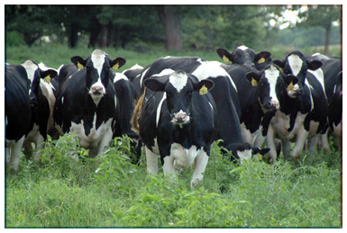
The 1950s saw the dairy industry become extensively regulated with the introduction of milk quotas for milk. By 1955, “Coral Vale” had been turned over to the production of whole milk, with a consequent shift to Friesian cattle which gave much more milk than the shorthorns.
“Coral Vale” remained a productive dairy unit until the 1980’s. Other farm activities during the dairying period included the cultivation of feed crops such as corn, saccaline and sorghum that would have been stored in the silo that stands today.
The 1980s saw the gradual breakup of “Coral Vale” to various owners. The remaining “Coral Vale” acres where mainly agisted and the lands where returned to grazing.

Coal was first discovered in the Wongawilli region around the 1880’s, however, the first coal mining activity didn’t take place until 1906. At first small amounts of coal were mined from 11 tons in 1906 increasing to 40 tons by 1910. Drays pulled by horse and oxen where used to transport the coal to Dapto Station.
The quality and quantum of the coal was widely recognised and this led to G & C Hoskins purchasing Wongawilli Colliery in 1916 to supply coke to their steel works in Lithgow. The Hoskins invested in the colliery establishing a washery, constructing beehive coke ovens and establishing the railway that opened in 1916.
BHP was to be the longest owner of the Wongawilli mine from 1935 to 2007. During this time the mine’s coal was used for the steel works at Port Kembla. The mine developed and changed its function during these years with the closure of the coking and washing facilities, the commencement and closure of the Bulli (#1) seam and the consolidation of Wongawilli, Nebo and Kemira Colleries into the Elourea Colliery in 1993. The Elourea Colliery was sold to Gujaret NRE in 2007 and was renamed the NRE Wongawilli Colliery.
The Wongawilli Mine was to lend its name to a pilliar extraction method of mining known as the modern Wongawilli Mining Method.
The Wongawilli system involves much larger blocks of up to 200 m wide. It consists of a 2 or 3 heading entry headings driven through the centre of the panels, splitting the panel into two smaller panels. The panel can be up to 1000 m long. Lifting of the fenders is carried out to the left and right of the split. This has been made possible with ‘the introduction of hydraulically operated Breaker Line supports (BLS) (Source; Mining Science and Technology - University Of Wollongong)